

OKLAHOMA CITY ( Free Press) — The Oklahoma legislative joint redistricting staff continue ongoing 2021 redistricting plans now that the delayed Census data is in and it’s going to result in more changes than first anticipated.
Completed Census data now show that there has been an even bigger shift in population in the state from rural to urban than was anticipated by the staff during the legislative session.
The Joint House and Senate redistricting committees have held 30 virtual and in-person town hall meetings since December 2020 to solicit public input during the process.
During the Oklahoma legislative redistricting staff virtual town hall meeting Wednesday night, joint redistricting staff covered state and nationwide population shifts, 2021 redistricting plans, and public map submissions requirements.
To learn more:
- Oklahoma House members listen to several redistricting map presentations
- OKC metro to gain House, Senate seats under new redistricting plan
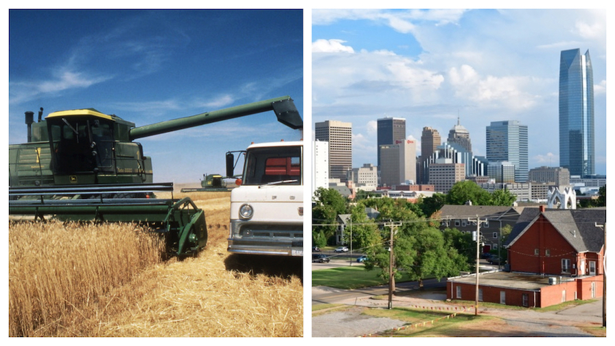
Unexpected population shift revealed
All House proposed district boundaries will be reassessed. Most districts in the metro areas grew more than estimated, while rural districts lost more population than estimated.
Twenty-seven counties added population with ten of those counties exceeding state growth, whereas 50 counties in the state lost population over the past decade.
Oklahoma lawmakers enacted plans for House and Senate districts during the regular 2021 session earlier this year based on the population estimate data from the 2015-2019 American Community Survey.
Due to COVID-related census delays, the timeline for redistricting the House and Senate districts has been extended. Congressional redistricting has no deadline, however, the Committees and Legislature are expected to vote on redistricting plans in November during their special session.
The release of the latest 2020 census data last month will enable the Legislature to redraw the state’s five congressional districts and modify new legislative district lines if necessary based on the most recent estimates.
Population Shifts
Statewide
- Oklahoma’s population increased by 5.5% from 2010 to 2020, according to the 2020 U.S. Census results.
- The state gained approximately 208,000 residents in the last decade.
- The total population of Oklahoma residents (2020) is 3,959,353.
- The state’s population is continuously shifting from rural communities to urban and suburban areas.
- According to the recent data, Canadian County was the fastest growing county in the state, with a population increase of 33.6% from 2010 to 2020.
Nationwide
- The U.S. population grew by 7.4% from 2010 to 2020, according to the recent data.
- The U.S. total population (2020) is 331,449,281.
- Gained approximately 23 million residents between 2010 and 2020.
- The U.S. population growth is the second slowest growth in recorded history.
- 86% of the U.S. population are living in metro areas in 2020. U.S. metro areas increased by 9% between 2010 to 2020.
Public Map Submissions still open
Similar to the legislative redistricting process during the regular 2021 session, Oklahomans can participate in the redistricting process by submitting map proposals for state congressional districts.
The Legislature is partnered with a free redistricting mapping resource, Dave’s Redistricting App, that allows Oklahoma residents to redraw the five congressional districts and submit them to the joint committee.
The map submission requirements are:
- Must be a statewide plan for five congressional districts.
- Must be an Oklahoma resident.
- Limit one plan submission per person.
- Must conform to House and Senate adopted redistricting guidelines for 2021.
- Oklahomans can email submissions to redistrictoklahoma2020@okhouse.gov with the following information:
- Name
- Organization (if applicable)
- Contact information (phone, email, address)
- Statement that summarizes the values/criteria that was prioritized with drawing the map.
- URL link to the map from Dave’s Redistricting App.
The deadline for congressional map submissions is Oct. 10. During the week of Oct. 18, the public will be invited to present map submissions to the joint committee.
Beginning in 2022, the newly enacted district lines will be used to conduct
State congressional and legislative elections. Sitting lawmakers elected in 2020 will continue to serve the remainder of their term.

Brianna Garcia is a freelance journalist covering local politics and culture for Free Press. She has a degree in Journalism from the University of Central Oklahoma.


