

Last Updated on October 20, 2021, 8:20 PM | Published: October 20, 2021
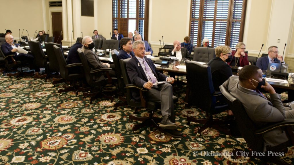
OKLAHOMA CITY (Free Press) — The Oklahoma House and Senate redistricting committee heard several public map presentations by Oklahomans who took part in the congressional redistricting process Tuesday morning at the State Capital.
In the hearing, the Joint redistricting committees received a total of 10 congressional map submissions by the public.
While committees reviewed all 10 redistricting plans that were submitted, only two of the presenters were in attendance to present the maps to the committee. The rest were briefly presented by the Joint redistricting staff.
Oklahoma is made up of five U.S congressional districts, which is based on the decennial U.S. census population data. Every 10 years, the Oklahoma Legislature redraws congressional and legislative district boundaries to reflect specific changes in the state, such as population size.
And, for the first time ever, Oklahomans have been invited to openly participate in the redistricting process.
Maps Presented
Dan Hough was the first to present his map proposal for the state’s congressional district to the committee. Hough said the main and only priority in his plan was to contain as much of Oklahoma County into Oklahoma’s 5th congressional district as possible.
“I believe the population growth in Oklahoma County merits its own district,” Hough said during the presentation. “I think the county’s diversity should be rewarded in this way.”
Currently, the 5th Congressional District is in the central part of the state and covers most of Oklahoma County and all of Pottawatomie and Seminole counties. Some major cities include Oklahoma City, Shawnee, Edmond, and Del City.
Hough made a few significant changes to the state district lines in order to accommodate fitting all of Oklahoma County into CD-5, such as:
- Moving Pottawatomie County out of CD-5 and placing it into Oklahoma’s 4th Congressional District.
- Moving Seminole County from CD-5 into CD-2.
- Added Tinker Air Force Base and eastern areas into CD-5.
- Moved Washington County from CD-1 to CD-2.
Hough also mentioned that he made sure Rep. Stephanie Bice was still in his version of CD-5.
Andy Moore is the Executive Director of People Not Politicians, a nonpartisan coalition of Oklahomans that worked to create an independent and transparent redistricting process in an effort to end gerrymandering.
Moore said his main goal while creating his map was to ensure equal representation, fairness, and common sense. Unlike the legislative process, Moore did not consider the place of residence of any sitting congressperson or legislature and only used the data provided by the Census.
In drawing his congressional district map, Moore also considered:
- Maintaining population concentration between districts.
- Minimizing the number of splits between countries while maximizing compactness.
- Preserving historic territory and shapes of existing districts while maintaining natural and political boundaries.
- Minority representation
- Integrating public input provided during the legislative redistricting town halls and meetings his organization held during the process.
“The thing about this [map] is that you reach a happy equilibrium with straightforward boundaries, a minimal number of counties split,” Moore said during his presentation. “We think that it is straightforward, makes sense, and a map that Oklahomans get behind.”
The rest of the map submissions were still briefly presented by the joint redistricting staff although the presenters were not in attendance to present them.
Sen. Julia Kirt asked the Joint redistricting committee why they were still presenting maps if the presenters weren’t there to present them.
“The goal of this committee has been transparency and so we want to make sure that they [the maps] do get presented whether they can be here or not for whatever reason that they’re not here,” said Chairman Lonnie Paxton.
Michael Ceasar’s map prioritized:
- Creating districts that have common cultural, economic, and regional interests.
- Creating districts that can choose based on common interests rather than political affiliation.
- Ensuring districts had a representative to best represent them.
- Using current county boundaries where possible.
J.D. Clark’s map proposal sought to:
- Maintain representation across the district.
- Create two districts that represent the metropolitan areas.
Clark’s version of CD-5 is made up of half of Oklahoma County and half of Cleveland County. Some notable cities that were split were Yukon, Jones, Collinsville, and Coweta.
Dividing the OKC metro
Pat McFerron’s map featured:
- Compactness
- Keeping counties whole while also considering population deviation.
- Limited splitting of existing precincts.
- Divides the Oklahoma City metropolitan area into several neighboring congressional districts that include large rural populations
John Hughes’ map prioritized:
- Keeping the core of Oklahoma City, Norman, and Edmond together.
- Limiting splitting between districts as much as possible.
- Minority representation.
Rachel Melot, with Shawnee Forward, submitted a map that:
- Splits counties such as; Canadian, Oklahoma, Wagoner, Creek, and Rogers
- Portions out the Oklahoma City metropolitan area into neighboring congressional districts with large rural populations
John Roberts’ map proposal mainly focused on:
- Keeping communities of interest together.
- Maintaining existing precincts as much as possible.
David Greene, who planned to attend the meeting but called in sick prior to the meeting, submitted his map proposal which:
- Prioritizes geodiversity.
- Contains numerous splits in highly populated areas such as Oklahoma and Tulsa counties.
Lastly, Owen Underwood’s map sought to prioritize:
- Population deviation while keeping communities of interest together, particularly in the metro areas.
- Keeping the same areas represented by the same representatives where possible.
Special Session 2021
The legislature will reconvene in a special session Monday, Nov. 15 to establish a congressional redistricting plan and make any necessary adjustments to the legislative districts passed earlier this year based on the 2020 Census data.
There is no particular deadline for congressional map redistricting.
Beginning in 2022, the newly enacted districts will be used to conduct elections. The primary election, which will be held on June 28, 2022, will be the first election to use the new district boundaries for House, Senate, and Congressional districts.
Correction: In an earlier version of this report we misspelled Senator Julia Kirt’s name. Our apologies.

Brianna Garcia is a freelance journalist covering local politics and culture for Free Press. She has a degree in Journalism from the University of Central Oklahoma.


